File:OperationChronoStormLATSetsMarked.jpg
Size of this preview: 759 × 600 pixels. Other resolution: 1,029 × 813 pixels.
Original file (1,029 × 813 pixels, file size: 142 KB, MIME type: image/jpeg)
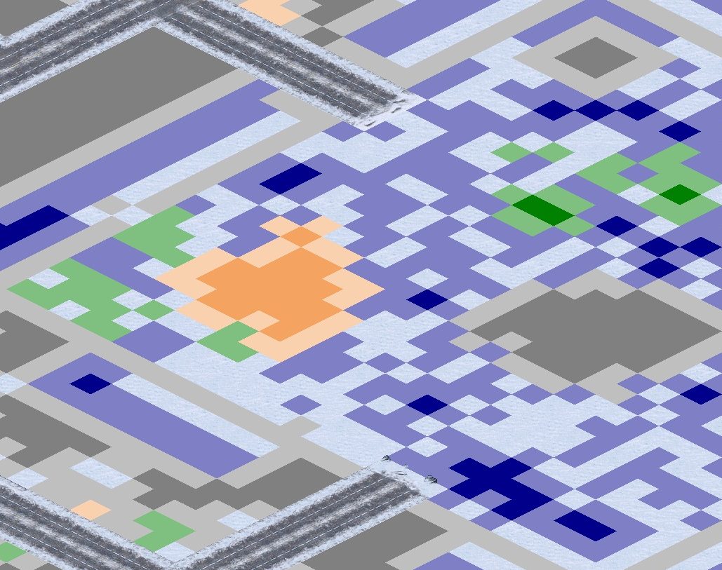
A section of the final Allied mission "Operation Chrono Storm" map from the Red Alert 2 Campaign. Tiles that are going to be affected by the Auto-LAT system are marked: PaveTiles are replaced with a gray tile, GreenTiles (which look icy on the snow theater) are replaced by a green tile, RoughTiles are replaced by a dark-blue coloured tile, and SandTiles are replaced by a brownish tile.
File history
Click on a date/time to view the file as it appeared at that time.
| Date/Time | Thumbnail | Dimensions | User | Comment | |
|---|---|---|---|---|---|
| current | 15:12, 1 April 2025 | | 1,029 × 813 (142 KB) | MarkJFox (talk | contribs) |
You cannot overwrite this file.
File usage
The following page uses this file: