File:ConnectingLATSetSubTileSelection.png
Size of this preview: 800 × 433 pixels. Other resolution: 992 × 537 pixels.
Original file (992 × 537 pixels, file size: 70 KB, MIME type: image/png)
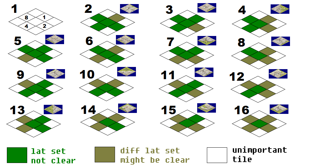
This sheet explains how the Auto-LAT system picks the correct tile from a connecting LAT set based on the neighbours of a tile.
File history
Click on a date/time to view the file as it appeared at that time.
| Date/Time | Thumbnail | Dimensions | User | Comment | |
|---|---|---|---|---|---|
| current | 23:03, 1 April 2025 | | 992 × 537 (70 KB) | MarkJFox (talk | contribs) |
You cannot overwrite this file.
File usage
The following page uses this file: